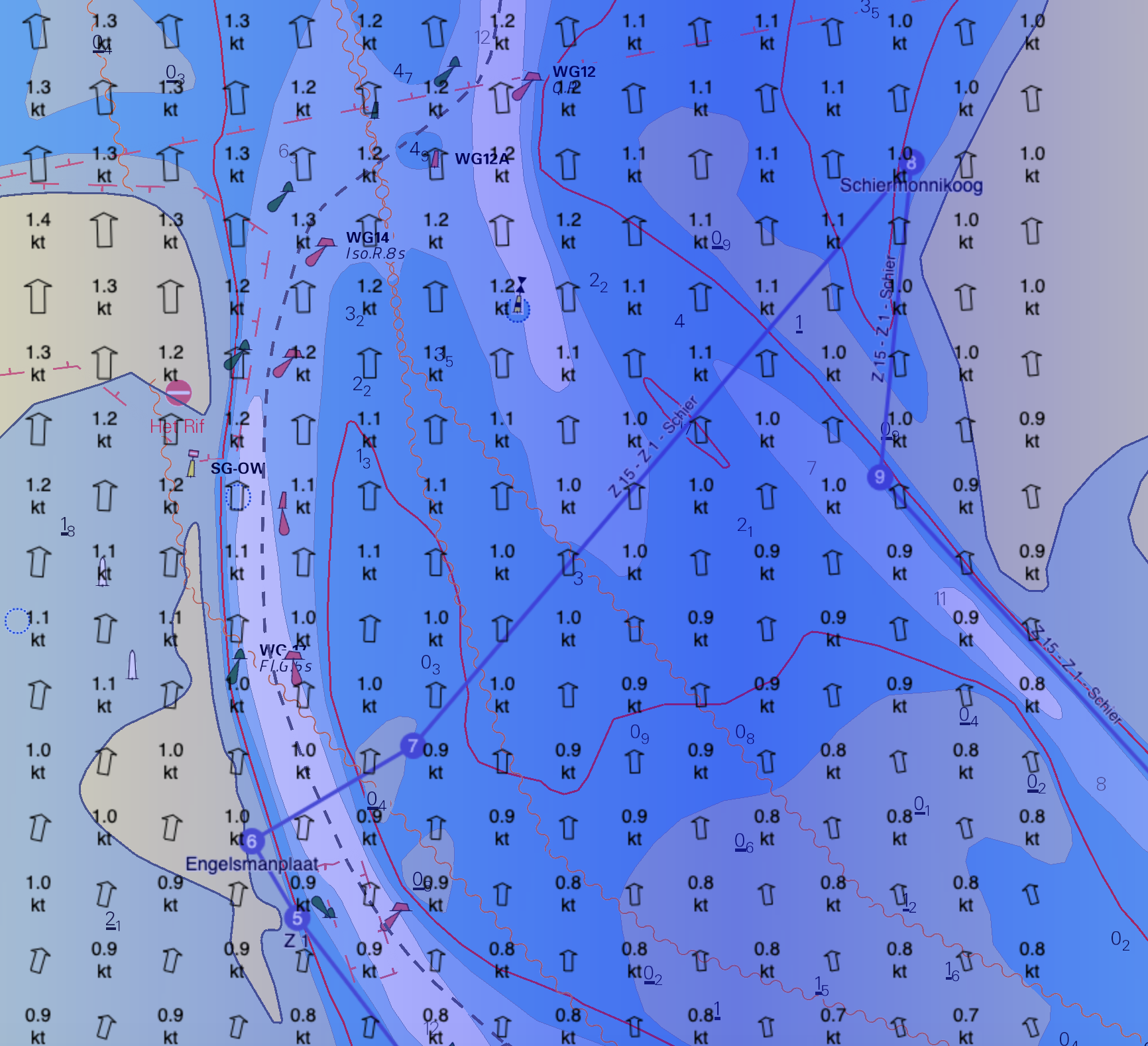
Route Planning Zoutkamperlaag Triangle
Date: Tuesday, July 28, 2026
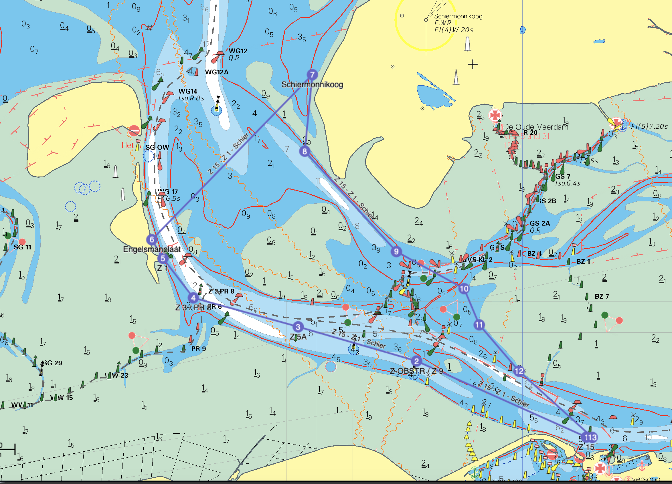
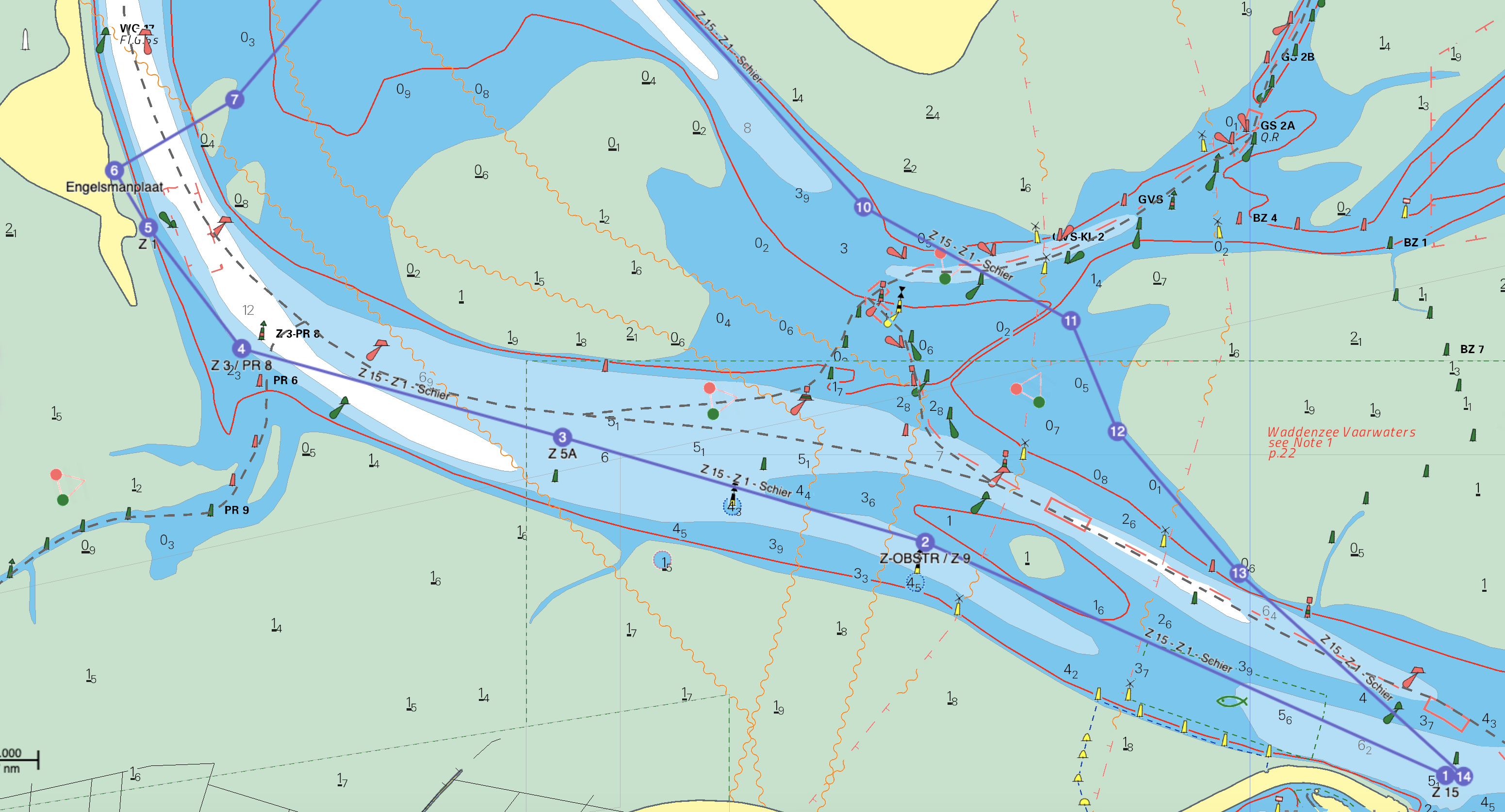
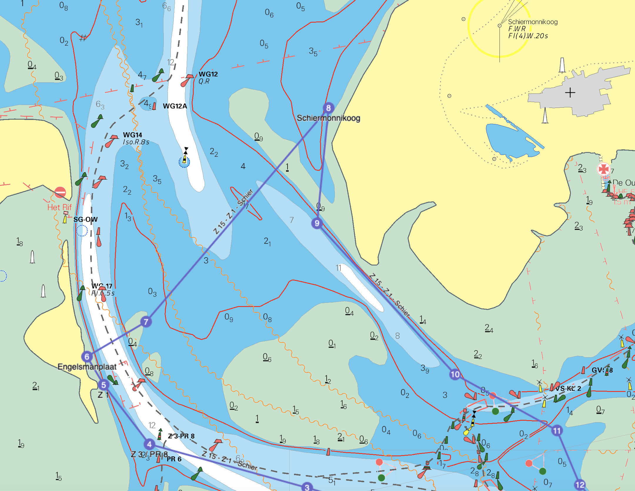
In coastal rowing, routes are largely determined by tides, currents, and wind. Below is a detailed example of the tour to the Engelsmanplaat and Schiermonnikoog.
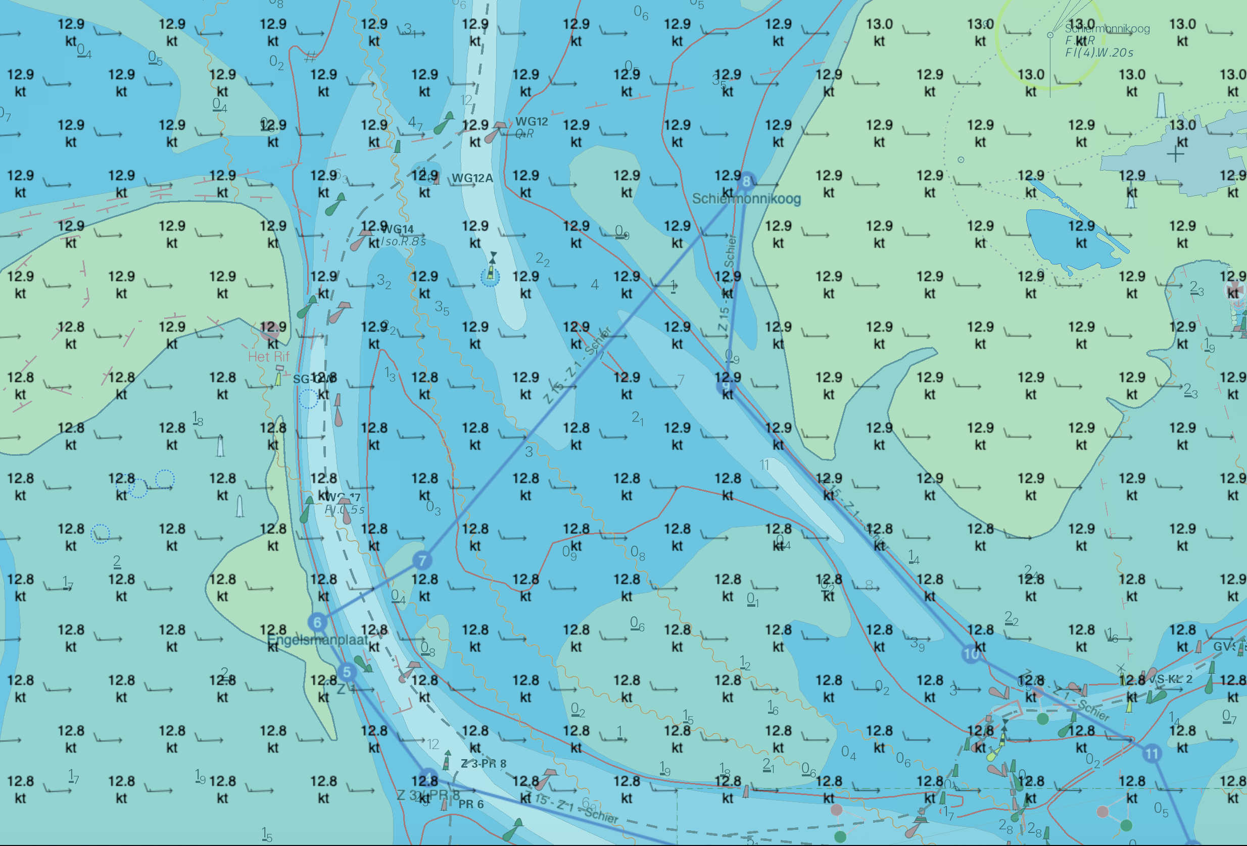
Wind Analysis (West 4 Bft)
- Outward Journey (Course NW): A west wind on a northwest course means an oblique headwind / crosswind from the front. Because the west wind opposes the outward (northwest) ebb current, extra wave build-up occurs (wind against current). A speed reduction of -2 km/h is calculated for this.
- Crossing (Course NE): The crossing from the Engelsmanplaat goes northeast. The west wind is directly behind us. A speed bonus of +1 km/h is calculated for this.
- Return Journey (Course SE): The return journey towards Lauwersoog goes southeast, providing a favorable oblique tailwind. A speed bonus of +1 km/h is calculated for this.
General Assumptions
| Parameter | Value | Parameter | Value |
|---|---|---|---|
| HW Lauwersoog | 10:44 | LW Lauwersoog | 17:00 |
| Base Boat Speed | 10 km/h | Departure Time | 11:00 |
| Wind Forecast | W 4 | Speed deduction (headwind) | -3 km/h |
| Particularities | Ebb current Westgat reaches approx. 3 kn (cross). Wind against current in stage 1! | Speed deduction (wind against current) | -2 km/h |
| Speed bonus (tailwind) | +1 km/h |
Route Planning
| Stage | Distance | Course | Wind cor. | Current | Boat Speed | Duration (min) | Arrival | Total km |
|---|---|---|---|---|---|---|---|---|
| Lauwersoog - Engelsmanplaat (Dep. 11:00) | 9.5 km | NW | -2 | +2 | 10 km/h | 57 | 11:57 | 9.5 |
| Break Engelsmanplaat | 0 km | - | 0 | 0 | 0 | 63 | 13:15 | 12 |
| Engelsmanplaat - Schiermonnikoog (Dep. 13:15) | 4.5 km | NE | +1 | 0 (cross) | 11 km/h | 25 | 13:40 | 14.0 |
| Break Schiermonnikoog | 0 km | - | 0 | 0 | 0 | 162 | 16:30 | 18 |
| Schiermonnikoog - Lauwersoog (Dep. 16:30) | 9.5 km | SE | +1 | +1 | 12 km/h | 48 | 17:18 | 23.5 |
Route Maps & GPX
Click on an image to enlarge it.