Routeplanning De Balg
Datum: October 1, 2026
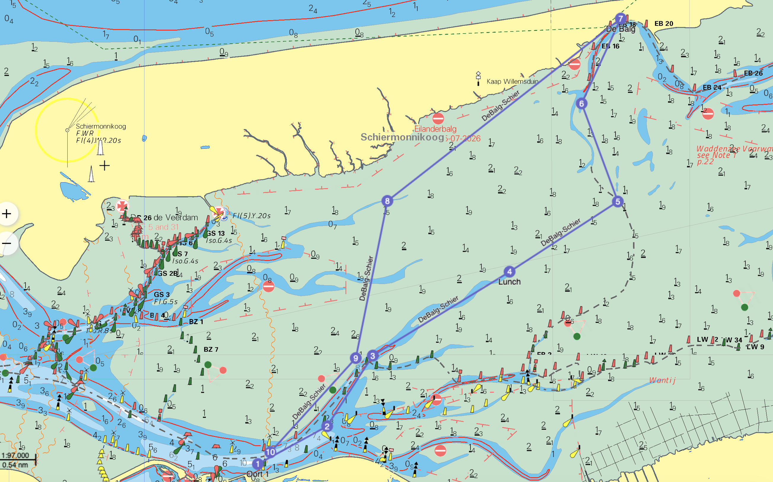
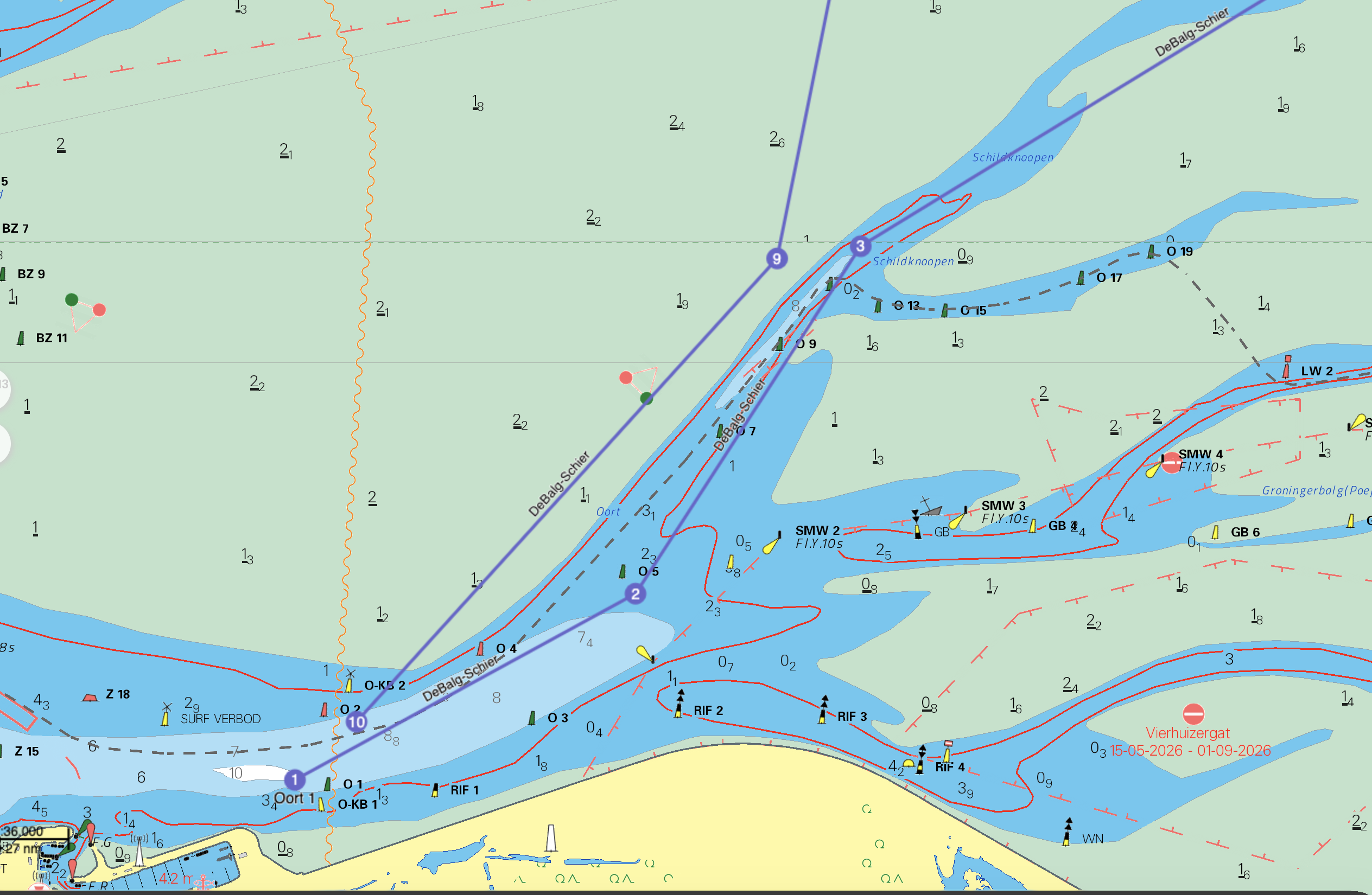
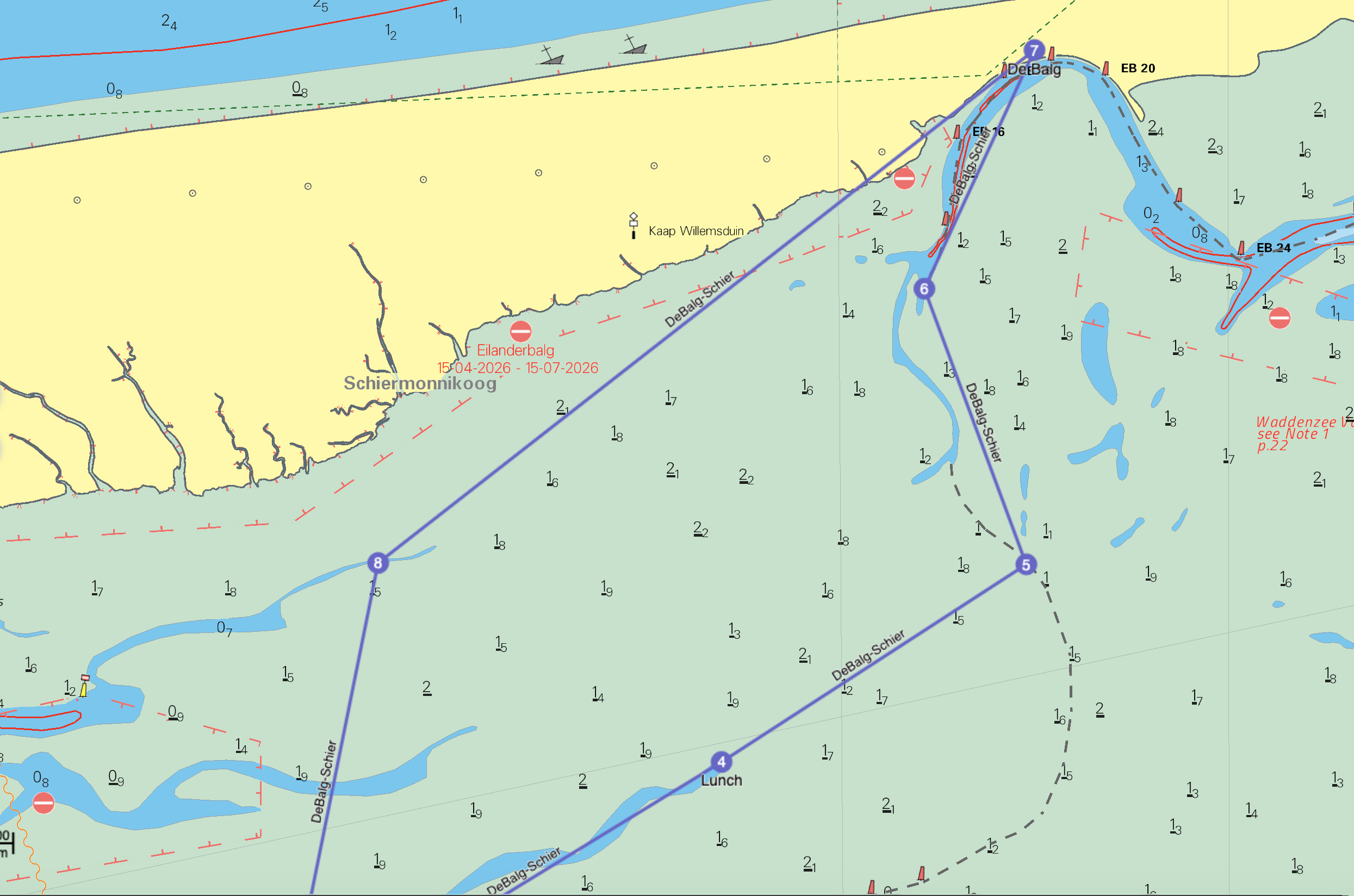
This route crosses the mudflats directly via Brakzand to De Balg. We take a break on the mudflats near Brakzand waiting for sufficient water.
Expected weather conditions, updated on September 25.
Wind Analysis (South 4 Bft)
- Outward to Brakzand (Course NE): A southerly wind on a northeast course means a broad reach / tailwind. The flood current is also favorable and running with us. A total speed bonus of +2.0 km/h is applied (+1.0 km/h wind, +1.0 km/h current).
- Brakzand to De Balg (Course NE): Still a tailwind, but the current is minimal near high water slack. A speed bonus of +1.0 km/h is applied (+1.0 km/h wind, 0 km/h current).
- De Balg to Lauwersoog (Course SW): An angled headwind on this long stretch southwestward over the watershed and along the south side of Schiermonnikoog. A speed deduction of -1.5 km/h is applied (-1.5 km/h wind, 0 km/h current).
General Assumptions (October 1, 2026)
| Parameter | Value | Parameter | Value |
|---|---|---|---|
| HW Lauwersoog | 14:18 | LW Lauwersoog | 08:00 & 20:19 |
| Base boat speed | 7.5 km/h | Departure time | 11:00 (Meet at 10:00) |
| Wind forecast | S 4 (18°C) | Speed deduction (headwind) | -1.5 km/h |
| Notes | - | Speed bonus (tailwind/current) | +2.0 km/h |
Route Schedule
| Stage | Distance | Course | Wind cor. | Current | Boat speed | Duration (min) | Arrival | Total km | |
|---|---|---|---|---|---|---|---|---|---|
| Lauwersoog - Brakzand (Lunch) (Dep 11:00) | 7.9 km | NE | +1 | +1 | 9.5 km/h | 50 | 11:50 | 7.9 | |
| Pause Brakzand (Wait for tide) | 0 km | - | 0 | 0 | 0 | 50 | 12:40 | 7.9 | |
| Brakzand - De Balg (Dep 12:40) | 7.9 km | NE | +1 | 0 | 8.5 km/h | 56 | 13:36 | 15.8 | |
| Pause De Balg | 0 km | - | 0 | 0 | 0 | 42 | 14:18 | 15.8 | |
| De Balg - Lauwersoog (Dep 14:18) | 14.2 km | SW | -1.5 | 0 | 6.0 km/h | 142 | 16:40 | 30.0 |
Route maps & GPX
Click on an image to enlarge.